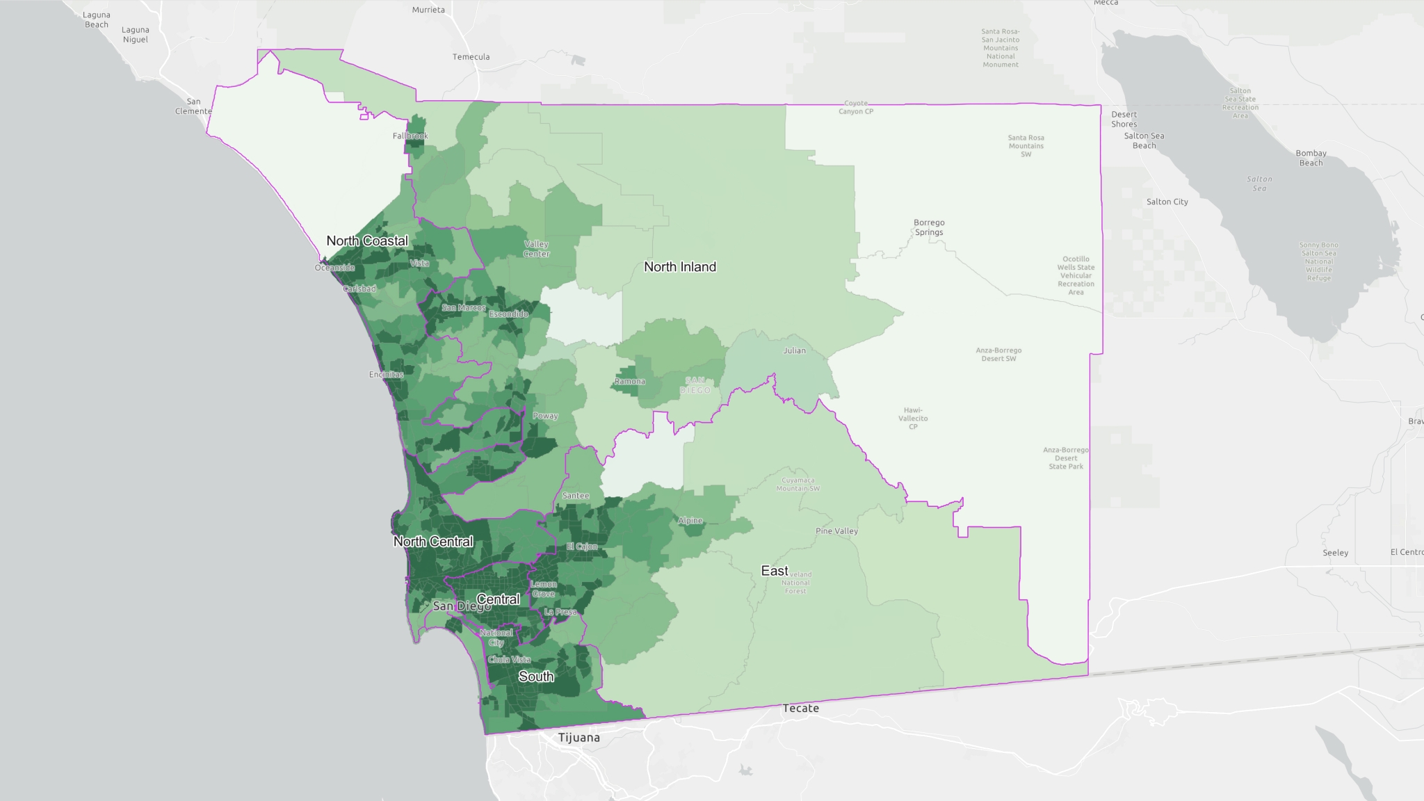
Alcohol Density is a Public Health Problem
Alcohol availability is a pressing public health issue. The more alcohol that is available, the more it is harmful to our health and increases DUI crashes, assaults, homicides, and sexual and domestic violence.
Furthermore, stores that sell alcohol for consumption off-site (“off-sale” license) are more likely to be found in low-income and communities of color, creating health and safety inequities for residents and businesses in these neighborhoods.
To understand these implications, alcohol density maps provide the baseline knowledge from which we can further investigate the relationship between too much alcohol and the factors that determine our health and safety.
Alcohol density is measured according to the CDC’s Measuring Alcohol Outlet Density toolkit. This map defines alcohol density as the average distance between a person and their closest alcohol retailer. The less someone has to travel to their closest retailer, the more available alcohol is to that person.
 To view a layer: Toggle the visibility icon next to the layer in the table of contents on the left-hand side to ensure it is set to show the layer you want to investigate.
![]() To identify a specific community in San Diego County: Zoom into the map using the zoom controls in the lower right-hand corner of the map.
To identify a specific community in San Diego County: Zoom into the map using the zoom controls in the lower right-hand corner of the map.
To view the alcohol density of a specific census tract: Click on the census tract for a pop-up window with specific information. The layer must be turned on to view its pop-up window.
Last Updated: 11/05/2025


